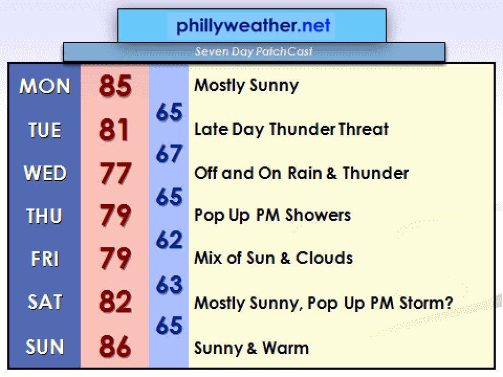
This weekend's foray into summery temperatures and warmth is thankfully not the start of a prolonged heat wave. The combination of a weak backdoor cool front pushing down from New England and a weakening ridge of high pressure in the atmosphere will help nudge temperatures back closer to reality for the start of the week. As the ridge of high pressure continues to weaken, a cool front to our west will nudge east towards us for the middle of the week, potentially bringing us heavy rain and a thunderstorm for Tuesday night and Wednesday.
Computer model projections show an inch of rain to perhaps over three inches of rain for Tuesday and Wednesday with higher rainfall totals possible over the Poconos. The combination of a moisture rich atmosphere, slow moving frontal boundary, and upper level wind trajectory will result in the possibility of thunderstorms popping up and tracking over the same area a few times in what is known is "training" ― not like those long webinars you love at the office, but rather storms taking the same track multiple times like trains over tracks.
The brunt of the event looks to arrive Tuesday night and early Wednesday locally, but with the front being slow to clear, the possibility of more showers and storms exists on Thursday thanks to lingering energy with the storm system. If we do pick up more than two inches of rain, localized flooding is a possibility along roads or in streams.
Find out what's happening in Upper Moreland-Willow Grovewith free, real-time updates from Patch.
As of now, next weekend looks pretty good.
There could be a few thunderstorms around on Saturday afternoon, but odds favor a generally decent weekend. Temperatures, which will dip to around 80 during the middle of the week for highs, will rebound and get back into the middle and upper 80s by Sunday. We could be back into the lower 90s early next week as high pressure builds just off shore and allows for warmth to bubble back into the region.
Find out what's happening in Upper Moreland-Willow Grovewith free, real-time updates from Patch.
--
Tom Thunstrom is the editor and publisher of Phillyweather.net. You can also follow Phillyweather.net on Twitter at @phillywx or on Facebook.